Aquaculture is a strategic sector, but its sustainable growth faces a key challenge: the availability of space and competition with other coastal uses. In this context, marine spatial planning, and specifically the designation of Allocated Zones for Aquaculture (AZAs), is essential. However, once a zone is designated, a crucial question arises: how much can it sustainably produce?
A recent study published in the journal Aquaculture addresses this issue. Researchers from the University of Alicante have applied an innovative proxy model based on Geographic Information Systems (GIS) to estimate the productive carrying capacity of the official AZAs for marine fish farming in the Spanish Mediterranean. This work not only maps the productive potential of these coastlines but also offers a valuable roadmap for more efficient and sustainable management of the sector.
- 1 Key conclusions
- 2 How is the production capacity of a zone measured?
- 3 The map of aquaculture potential in the spanish Mediterranean
- 4 The power of best practices: Self-limiting factors
- 5 A roadmap for the future: Optimize without expanding
- 6 Conclusion: A tool for adaptive management
- 7 Entradas relacionadas:
Key conclusions
- The majority (81.8%) of the area within the Allocated Zones for Aquaculture (AZAs) in the Spanish Mediterranean is classified as having a medium carrying capacity (MCC).
- Andalusia is the only autonomous community with zones of high carrying capacity (HCC), representing 13.1% of its available AZA, primarily in Almería.
- None of the 30 existing fish farming concessions currently operate in high-capacity zones (HCC), which indicates significant potential for optimization for future licenses.
- The implementation of best practices by producers, such as feed optimization or the spatial arrangement of cages, can significantly increase a site’s production capacity.
How is the production capacity of a zone measured?
To estimate the carrying capacity—defined as the maximum harvest in live weight (tons per hectare per year) that an area can support without causing undesirable environmental effects—the researchers used a holistic model that integrates eight key factors. These factors cover four fundamental dimensions:
- Technical-Productive: Amount of feed per hectare, spatial layout of the concession, and distance between facilities.
- Environmental: Distance to priority habitats (such as Posidonia oceanica meadows), depth, and current velocity.
- Social: Employment generated per million inhabitants.
- Economic: Unit cost of production.
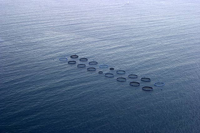
The study area, covering more than 570,000 hectares of AZAs in Catalonia, the Valencian Community, the Region of Murcia, Andalusia, and Ceuta, was divided into a grid of 1×1 km cells. Each cell was assigned a weighted value for each georeferenced factor, allowing for the calculation of its specific carrying capacity.
The map of aquaculture potential in the spanish Mediterranean
The study’s results classified the zones into three categories: low carrying capacity (LCC), medium (MCC), and high (HCC). The overall picture reveals that the potential for Spanish aquaculture is considerable, but with significant regional differences.
Under a neutral scenario, the vast majority of the analyzed area (81.8%) was classified as having a medium carrying capacity (MCC), which was the dominant category in all regions.
The big surprise came from Andalusia, which was the only community with high carrying capacity (HCC) zones, accounting for 13.1% (16,044 ha) of its AZA. The province of Almería stands out, with 31.2% of its AZA falling into this category. The reason? A combination of highly favorable environmental factors: deeper waters (generally below 50 meters) and higher current velocities (above 10 cm/s), which improve nutrient dispersion and oxygenation. This is complemented by a powerful social factor: the employment generated, which received the highest rating in Almería.
On the other hand, the Valencian Community and Catalonia showed the largest proportions of low carrying capacity (LCC) zones, with 23.3% and 16.2%, respectively. These LCC areas tend to be in shallower zones (often less than 25 meters deep), closer to the coast, and, in some cases, near priority habitats.
The power of best practices: Self-limiting factors
One of the study’s most interesting findings is the crucial role of “self-limiting factors.” These are variables that depend directly on the producer’s management at the farm itself, such as the amount of feed used, the distribution of cages within the concession, and the cost of production.
Stay Always Informed
Join our communities to instantly receive the most important news, reports, and analysis from the aquaculture industry.
The model showed that by optimizing these factors, a site’s carrying capacity can increase dramatically. The factor with the greatest impact was the amount of feed per hectare. Reducing the amount of feed—whether by choosing species with better conversion rates, more efficient formulations, or precision feeding systems—not only increases the sustainable productive capacity of the area but also reduces the carbon footprint and production costs.
Similarly, a better spatial arrangement of the cages, leaving more free space between them, also contributes to a higher production capacity. This demonstrates that the management and technology applied by aquaculturists are just as important as the site’s environmental conditions.
A roadmap for the future: Optimize without expanding
Perhaps the most revealing finding of the study is the result of overlaying the carrying capacity map with the locations of the 30 existing fish farming concessions:
- 0% of farms are located in high-capacity zones (HCC).
- 66.7% operate in medium-capacity zones (MCC).
- 20% are located in low-capacity zones (LCC).
This distribution highlights a clear opportunity for the sector. There are high-potential productive zones, identified by the model, that are currently unoccupied. Directing future licenses toward these HCC cells would allow the industry to significantly increase sustainable production without needing to expand the total spatial footprint of aquaculture.
Conclusion: A tool for adaptive management
This study demonstrates that integrating carrying capacity models into a GIS environment is a powerful and feasible tool for aquaculture spatial planning. It offers both public administrations and companies a data-driven framework for making informed decisions, whether for granting new concessions or selecting sites with high productive potential.
The authors emphasize that these results should not be seen as fixed limits but as a starting point for adaptive management. The model is modular and exportable, allowing it to be updated with new data and adapted to other regions and habitats. With proper training and data access, these tools can transform static suitability maps into a dynamic decision-support system, driving a more productive, sustainable, and evidence-based development of aquaculture.
Contact
Linda Fourdain
Department of Marine Science and Applied Biology, University of Alicante
POX 99, 03080 Alicante, Spain
Email: linfourdain@gmail.com
Reference (open access)
Fourdain, L., Forcada, A., Sánchez-Jerez, P., & Toledo-Guedes, K. (2025). From proxy to practice: GIS-based evaluation of production carrying capacity in pre-selected allocated zones for aquaculture. Aquaculture, 743134. https://doi.org/10.1016/j.aquaculture.2025.743134
Editor at the digital magazine AquaHoy. He holds a degree in Aquaculture Biology from the National University of Santa (UNS) and a Master’s degree in Science and Innovation Management from the Polytechnic University of Valencia, with postgraduate diplomas in Business Innovation and Innovation Management. He possesses extensive experience in the aquaculture and fisheries sector, having led the Fisheries Innovation Unit of the National Program for Innovation in Fisheries and Aquaculture (PNIPA). He has served as a senior consultant in technology watch, an innovation project formulator and advisor, and a lecturer at UNS. He is a member of the Peruvian College of Biologists and was recognized by the World Aquaculture Society (WAS) in 2016 for his contribution to aquaculture.
: Technology, Design, and Profitability")
 2026: A Comprehensive Guide to Aquaculture 4.0 via AI and IoT Integration")

: Complete care guide for aquarium, eeding, breeding, and common illnesses")