Washington, USA.- For decades the National Park Service has been locked in a battle against lake trout, an invasive fish with a voracious appetite that has overtaken Yellowstone Lake and upended its formerly thriving ecosystem. According to new research, an aircraft-mounted instrument could offer a faster way to locate and capture the non-native fish during the brief weeks each year when they come into shallow water to spawn.
The instrument, which uses the light-based imaging technology Light Detection and Ranging (LiDAR), could allow those who manage the lake to hunt for invasive fish across a wider area at lower cost, making more efficient use of the approximately $2 million spent on lake trout control each year.
In The Optical Society (OSA) journal Applied Optics, researchers report on a series of test flights that were successful in locating groups of lake trout and identifying previously unknown spawning areas. They demonstrate the technique’s ability to find groups of two or more lake trout swimming as deep as 15 meters below the surface.
“The key problem we address with this research is the need for a method to find where the invasive lake trout spawn so fisheries biologists can deploy various methods of reducing their population,” said Joseph A. Shaw, Montana State University. “There are several other methods being explored for tracking these fish, including acoustic sensing, but an airplane can cover the large lake in a much shorter time than is possible for boats.”
A new way to look at lakes
LiDAR has been used to track fish in marine ecosystems, but this is the first time it has been used to study fish in lakes, where the water is cloudier.
In addition, while other LiDAR applications require expensive, sophisticated equipment, Montana State University engineers developed the new instrument for less than $100,000 and optimized it for operation on a single-engine airplane that can be flown for $500 per day, making it a practical solution for ecologists and local fishery and water resource managers.
“The relatively low-cost and small size of our LiDAR system will make it useful for other types of ecological studies, such as mapping plankton layers and plumes from underwater vents,” said Shaw. “Remote lakes that would be difficult to access from the ground can be easily mapped and studied within the span of a single day.”
Stay Always Informed
Join our communities to instantly receive the most important news, reports, and analysis from the aquaculture industry.
Managing a threatened ecosystem
A centerpiece of Yellowstone National Park, Yellowstone Lake has long been beloved by anglers and revered for the populations of grizzlies, bald eagles, otters and other wildlife it supports. The introduction of non-native lake trout in the 1990s dramatically disrupted the area’s intricate ecological balance.
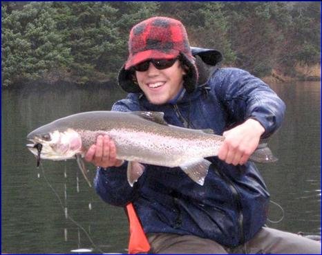
Lake trout prey upon the lake’s native cutthroat trout, which have historically been a key food source for many top predators. As lake trout populations spiked, the cutthroat trout population collapsed, dropping by 90 percent between 2000 and 2005. This substantially reduced the food supply for bears, birds and other animals. These animals cannot prey upon the invasive lake trout because lake trout spend most of the year in deep water, unlike cutthroat trout.
To cull lake trout populations and give cutthroat trout a chance to recover, lake managers use gill nets, among other methods, to capture lake trout during spawning season. While highly effective, this method requires knowing when – and more importantly, where – the fish are spawning.
To locate the fish, biologists currently implant individual fish with acoustic transmitters and then track them with in-lake and on-boat receivers, a time-consuming and labor-intensive process that provides incomplete coverage of the invasive fish’s whereabouts.
Taking to the air to cover more ground
The research team sought to develop a more effective way to quickly locate large groups of lake trout without tagging. Their solution, a LiDAR instrument bolted to a small aircraft, allows them to detect fish in a 5-meter swath of water and cover 80 kilometers per hour.
The device works by transmitting a short pulse of laser light from the airplane through the air and into the water. The LiDAR receiver measures backscattered light, allowing researchers to pick out fish from the surrounding water. To optimize the setup for use on the lake, they used a green-beam laser, which penetrates water better than other types of lasers used for LiDAR applications on the ground. The beam was angled backward so that the light’s reflection on the water is deflected away and does not saturate the receiver.
Putting the system to the test
The team first tested the use of LiDAR technology at Yellowstone Lake using the NOAA fish LiDAR in 2004. Data collected during those test flights helped National Park Service personnel find previously unknown spawning areas that were then validated with on-the-ground gill netting operations.
The team then designed and built their own system to provide sufficient optical power at the lowest possible cost. Tests of the new setup, in 2015 and 2016, successfully identified numerous trout groupings.
Shaw said the system could be further improved with a technique called push-broom scanning, in which the laser beam is scanned in a line to cover a wider swath. This would allow scanning the full lake area more quickly than the single fixed-angle laser used in the current setup.
The researchers also aim to develop additional tools to help users rapidly translate LiDAR-generated data into actionable information, and to adapt the system for other types of freshwater ecosystems.
“We are interested in developing automated fish-detection algorithms and in using this method as a routine tool to help the fisheries biologists in their battle against invasive lake trout,” said Shaw. “We also are exploring options for using this LiDAR, along with multispectral and hyperspectral imaging systems, to monitor river health.”
This work was supported by funding from the National Science Foundation (NSF) and the State of Montana and was performed in collaboration with the National Oceanic and Atmospheric Administration’s Earth System Research Laboratory in Boulder, Colorado.
Reference:
M.R. Roddewig, J.H. Churnside, F.R. Hauer, J. Williams, P.E. Bigelow, T.M. Koel, J.A. Shaw, “Airborne LiDAR Detection and Mapping of Invasive Lake Trout in Yellowstone Lake,” Applied Optics, Volume 57, Issue 15, 4111-4116 (2018). DOI: 10.1364/AO.57.004111
https://www.osapublishing.org/ao/abstract.cfm?uri=ao-57-15-4111&origin=search
Editor at the digital magazine AquaHoy. He holds a degree in Aquaculture Biology from the National University of Santa (UNS) and a Master’s degree in Science and Innovation Management from the Polytechnic University of Valencia, with postgraduate diplomas in Business Innovation and Innovation Management. He possesses extensive experience in the aquaculture and fisheries sector, having led the Fisheries Innovation Unit of the National Program for Innovation in Fisheries and Aquaculture (PNIPA). He has served as a senior consultant in technology watch, an innovation project formulator and advisor, and a lecturer at UNS. He is a member of the Peruvian College of Biologists and was recognized by the World Aquaculture Society (WAS) in 2016 for his contribution to aquaculture.


