by Eric Hamilton, University of Florida
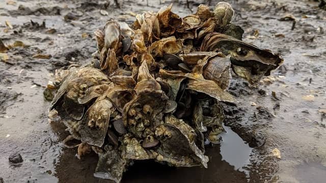
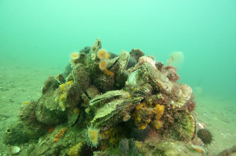
Skimming 100 feet above the Gulf waters at 13 miles per hour and blasting out 700,000 laser pulses every second, a drone flies over this oyster reef off the Big Bend coast of western Florida in early 2021. A few minutes later, the drone lands on shore and, with a little computer magic back at the lab, spits out what the drone operators want to know: How are these reefs doing?
Oyster reefs across the Gulf and Atlantic coasts of the U.S. – vital providers of food, jobs, habitat, shore protection and water purification – are facing steep declines from overharvesting and environmental stressors. But spotting which reefs are at risk of collapse in time to intervene using conventional methods can be labor intensive and impractical.
Enter the drone.
“In the time it takes a person to measure just one or two square meters of reef, you can survey the entire reef structure with a drone,” said Michael Espriella, a postdoctoral researcher at the University of Florida.
New research by Espriella and his UF colleagues shows that the digital elevation map produced by drone-based lidar – which pushes out rapid laser pulses that can measure distance – can accurately determine the condition of an oyster reef with much less time and labor than old-fashioned manual surveys.
That means more reefs can be surveyed faster, giving resource managers a chance to intervene before a reef disappears.
“These drone surveys can have a lot of value in pinpointing early signs of deterioration,” Espriella said “With enough surveys of reefs around the state, managers could dig deeper into specific situations and hopefully prevent larger collapses.”
These collapses of oyster beds have closed fisheries, such as the one in Florida’s Apalachicola Bay. In 2020, the state halted all oyster harvesting for five years while it tries to reverse the damage.
For years, Espriella and his team have been trying to develop a better way to measure the condition of these oyster reefs. One commonly used traditional method relies on walking over the reefs at low-tide and placing a square grid on a section of reef. A person then manually counts how many live oysters are in that one square meter of space. That can take more than ten minutes and captures just a tiny part of a reef.
Stay Always Informed
Join our communities to instantly receive the most important news, reports, and analysis from the aquaculture industry.
Since a drone flyover of an entire reef takes about the same amount of time as a single manual count, it is much more efficient. Software then produces a three-dimensional model of the reef based on the lidar scan. In their latest work, Espriella’s group discovered that the volume of the reef correlates well with the manual oyster counts.
“The volume-to-area ratio had the best parallel to ecological patterns and processes,” Espriella said. “Oysters will often orient themselves in clusters. I think there’s potential to better explore how volume derived from these models can quantify those.”
Espriella collaborated with UF’s Vincent Lecours, Edward Camp, Andrew Lassiter, Benjamin Wilkinson and Peter Frederick and University of Oxford’s Simon Pittman on the analysis. They published their findings April 10 in the journal Ecological Indicators.
Reference (open access)
Michael C. Espriella, Vincent Lecours, Edward V. Camp, H. Andrew Lassiter, Benjamin Wilkinson, Peter C. Frederick, Simon J. Pittman. 2023. Drone lidar-derived surface complexity metrics as indicators of intertidal oyster reef condition, Ecological Indicators, Volume 150, 2023, 110190, ISSN 1470-160X,
https://doi.org/10.1016/j.ecolind.2023.110190.
Editor at the digital magazine AquaHoy. He holds a degree in Aquaculture Biology from the National University of Santa (UNS) and a Master’s degree in Science and Innovation Management from the Polytechnic University of Valencia, with postgraduate diplomas in Business Innovation and Innovation Management. He possesses extensive experience in the aquaculture and fisheries sector, having led the Fisheries Innovation Unit of the National Program for Innovation in Fisheries and Aquaculture (PNIPA). He has served as a senior consultant in technology watch, an innovation project formulator and advisor, and a lecturer at UNS. He is a member of the Peruvian College of Biologists and was recognized by the World Aquaculture Society (WAS) in 2016 for his contribution to aquaculture.


